Mount Everest
From Wikipedia, the free encyclopedia
| Mount Everest | |
|---|---|
 Everest from Kala Patthar in Nepal | |
| Elevation | 8,848 m (29,028 feet)[1] Ranked 1st |
| Location | |
| Range | Mahalangur Himal, Himalaya |
| Prominence | 8,848 m (29,028 feet) |
| Coordinates | Coordinates: [3] |
| First ascent | May 29, 1953 |
| Easiest route | South Col (Nepal) |

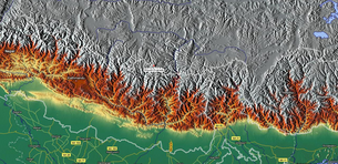
Mount Everest, also called Chomolungma or Qomolangma (Tibetan: ཇོ་མོ་གླང་མ) or Sagarmatha (Nepali: सगरमाथा) is the highest mountain on Earth, as measured by the height of its summit above sea level, which is 8,848 meters or 29,028 feet. The mountain, which is part of the Himalaya range in High Asia, is located on the border between Nepal and Tibet, China. By the end of the 2007 climbing season there had been 3,679 ascents to the summit by 2,436 individuals. There have been 210 deaths on the mountain, where conditions are so difficult that most corpses have been left where they fell; some are visible from standard climbing routes.[4]
Climbers range from experienced mountaineers to relative novices who count on their paid guides to get them to the top. This means climbers are a significant source of tourist revenue for Nepal, whose government also requires all prospective climbers to obtain an expensive permit, costing up to $25,000 (USD) per person.[5]


Tidak ada komentar:
Posting Komentar